22 July 2013

A Geologic Legacy: the Owyhee Desert

My idea to use these ancient proto Yellowstone volcanic fields as a basis for Nevada trip taking so far has surpassed my wildest expectations.  First on the docket was the Owyhee Desert, which you may remember as "Nevada's Bald Spot."

While the desert overlaps into both Idaho and Oregon, if you've looked at a map of Nevada the Owyhee desert, even just the Nevada portion, is HUGE.  Four hours of driving and we managed only to explore the Western half of the very Southern edge of the desert.

Yet despite its geologic significance, I can find very little written on the subject of the Nevada side.  There is a lot of talk about the Lake Owyhee field and the Owyhee Uplift in Oregon; also for Santa Rosa-Calico in Nevada, but not so much for the South Owyhee-Humboldt.  So I reckon it's going to have to suffice to say that it was active 15-13 million years ago.

But that didn't prevent a weekend of wonder and merriment, and it all started here, in Squaw Valley, just downwind from Midas. 

We definitely took the road less traveled (Left).

The "Caldera Rim" taunting, daring even, to brave the dusty trail.


This took us up Scraper Creek for a good long while, although the road to Scraper Spring was dilapidated...neglected.  So we headed for the route that would take us around to the East of the Burner Hills.


Whatever dug this hole must be about the size of one of my basset hounds.
I really didn't want to see one of these in the middle of the night.

This route, however, does present a couple of nice little chunks of geologic history.

 Ashfall tuff.

And...a close-up, including some past residences.

Mmm...igneousy.

By this point we were starting to get glimpses of what awaited us.

Our forecast calls for gently rolling hills, followed by extended periods
of light blue flatness.

And, true to expectation, there was the desert...

Looking East.

...a LOT of desert.


 Burner Hills from the North.

 Again looking East.


 One of the better sections of road.


Every so often the contour is interrupted by broad, stubby stream channels.  Often the upper reaches of these channels had cut through lava, so running down one side, then up the other, provides a small degree of peril (we never knew if we'd find ourselves unable to continue, forced to retreat from whence we came).


It is something akin to exploring Wyoming without having to drive for a day and a half.  Unlike Wyoming, however, I thoroughly enjoyed this remote section of Nevada.  With almost no perceptible topographic changes the trail weaves in and out of the Great Basin, flirting mildly with the Snake River drainage. 

It is unending solitude; awe-inspiring vastness; unspeakable serenity - interrupted only by the occasion cow pie.  For me, driving the Owyhee is a truly transcendental experience.

 The road, however, progressively deteriorated the farther we went.
It was never terrible, but obvious that very, very, very few people 
ever venture down that path.


 Why does this road keep bending?


There are the occasional signs of humanity, like the McCleary Wells 1 & 2.

Our route took us to Well 2. 

And an almost constantly changing biome.  

Not too often we find lichens growing on sagebrush - let alone red lichens.

Of course the geography begins to change rapidly toward the edge of the desert.

Milligan Creek Canyon

Approaching the Confluence of Milligan Creek and the
South Fork, Little Humboldt River at Button Field

And a simple little digital camera can't do much justice for some of the treats that await the rare, daring traveler.


 Button Field/Little Humboldt Ranch in the distance and the end of the great Owyhee.

And then, faster than it seems to begin, the Owyhee is done.  Past.  A thing to the East.  Now is the Humboldt river drainage.  The road forks, and after a period of deliberation the decision was made to go left...again.  Left had served us quite well thus far, anyway.  

Photo courtesy of David Colborne.

This became the second most terrifying moment of my life.  Luckily, the builder of the bridge used iron "I" beams for support, and it is less than 20' long.  Still, the boards feel/sound like they are the worse for the wear and the iron beams do not line up terribly well with a wheel base.  BUT...it's enough to hold my little Jeep driving over it just as fast as that road will allow.  

It also didn't help to get out and look around.  It's a good 15' drop under that bridge with a foot of concrete on either end.  But, in the end, we live to drive another day.  Which will be the next blog entry!

So upon seeing the South Fork of the Little Humboldt River...


...the objective for the day is behind the bluffs in the rear view mirror. 

Gone but not forgotten.

But it also seemed that my goal of reaching the Virgin Valley was not the least bit feasible - at least not after leaving Reno at 9:AM. 

If you look closely, you can see the hills are laughing at me.

So on to Pleasant Valley!  Then back to Winnemucca and tasty, tasty sweetbreads at the Martin Hotel.

As far as the Owyhee Desert goes...I can't WAIT to go back.  No, seriously.

Seriously.

15 July 2013

Introduction: A Geologic Legacy

Take a look at a topo map or a satellite image of far Northern Nevada, between the Bull Run and Tuscarora Mountains on the East and the Santa Rosa range on the West, and you'll notice a very large, abrupt, roundish flat spot right below the state line and overlapping into both Oregon and Idaho.  This is the Owyhee Desert, somewhat underheralded in the greater scheme of Nevada deserts (Black Rock or bust!).

It's like Nevada's bald spot!

Thanks to that image from Google Maps you can get some idea of the scale of the great Owyhee Desert.  It's also pretty remote: the nearest thriving metropolii (from the Nevada side) are Paradise Valley (in Humboldt County), Midas, Tuscarora, Owyhee, and Mountain City (all in Elko County) via old dusty trails.  Now consider this: it is all one massive volcanic caldera.

And not just any caldera; it is just one of a sequence of several massive volcanic fields that can be traced from far Western Nevada into Western Wyoming.  13.0-12.8 million years ago the Owyhee-Humboldt supervolcano was THE place to be if you were magma.  Once fed by an enormous mantle plume the region is long since cold; but the hot spot that created the caldera is still warm and very much active under Yellowstone National Park.

The Arc de Triomphe d'un Panache Mantellique.

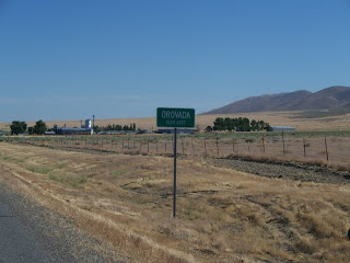
Now this is a Nevada-related blog, so our goal is not to trace the entire geologic history of the Yellowstone Hotspot.  But I have decided it could make interesting reading and would make great traveling to visit these ancient volcanic fields.  Not only will I get to see these natural wonders, but visiting such places as the Cottonwood Creek, Hanging Rock, Badger Mountain, and Virgin Valley calderas will take me to Soldier Meadows and High Rock Canyon; the McDermitt Volcanic Field/Orovada Rift will take me to the Santa Rosas and Ft. McDermitt country; Owyhee will take me to Midas; and the Bruneau-Jarbidge field will, of course, take me to Jarbidge.  So, hopefully, this will turn into a series of articles coalescing around the theme of the Yellowstone Hotspot in Nevada.


Montana Mountains, Kings River Valley; I didn't realize when
I took the picture that this is the Western flank of the
McDermitt Caldera.

Ooh, this will be fun!

10 July 2013

Project Shoal

October 26, 1963.

28 miles Southeast of Fallon, the Sand Springs range is going silent.  It has been teeming with activity, but for now a brief respite for the rolling hills and granitic outcrops.  It is the calm before the storm; at 10:AM the 20th century will greet these ancient knolls with a bang, and the ambassador is "Project Shoal."


After a series of earthquakes struck the area some 9 years previous, the site was selected to contribute to "Vela Uniform" (a part of "Project Vela").  On September 6, 1962 Public Land Order 2771 (amended by Public Land Order 2834) withdrew a 4 square mile area from the Bureau of Land Management and transferred authority to the AEC.  A 1,205 foot shaft was sunk with a 1,050 foot drift was run to the East at that 1,205 foot level.  And on our day here a 12.5 kiloton atomic bomb (or .8 of a Hiroshima "Little Boy" bomb) was detonated from that final location, just under 1/4 mile below the rangetop (well, not quite the summit, but close enough for government work).

The specific goal of Project Shoal was "...designed to investigate the behavior and characteristics of seismic signals generated by a nuclear detonation in a granite rock formation and to differentiate them from seismic signals generated by naturally occurring earthquakes."  (See link below: "Remediation, Project Shoal Area.")  Its parent, Vela Uniform, was born in 1959 as a joint project between the Department of Defense and the Atomic Energy Commission in order to, in the greater scheme of things, better detect nuclear detonations.  All of this ultimately ended up under "Project Vela," a part of the 1963 Partial Test Ban Treaty (it's not that we didn't trust the Soviets, but...).

Currently there is no surface contamination at the site.  The detonation created a chamber with a diameter of approximately 166-171 feet.  This, upon collapse, created a "nuclear rubble chimney" ca. 356-446 feet high.  This chimney, of course, contains radioactive contamination.  However, considering the chimney did not compromise to the surface and is at a depth of ca. 759-849 feet below ground level (above the point of detonation) the lack of contamination at the surface becomes reasonably clear.  Flowing groundwater is suspected of transporting radioactive contaminants, but due to the remote location and depth exposure is considered extremely unlikely.

Today the site is marked by a granite monument.

I have to appreciate the irony of the "style" of monument chosen.

Monitoring "stations" are also scattered about - big, red boxes that are impossible to miss.

I don't know why I didn't take a picture of the whole box.
But benchmarks are cool too, yes?

The tailings from the 1,204 foot shaft are also clearly visible at the site.


Being one of ten underground nuclear tests conducted outside the Nevada Test Site, the site is not without historical value.  And excluding the dynamic (read: atomic) history of the location, this is a neat place to see.  The visitor will be treated to sweeping vistas...

The Salt Wells are beautiful this time of year.
(Four Mile Flat w/ the Salt Wells Basin beyond and the
Lahontan Valley way beyond.)

...fancy geology...

Rocks will be rocks.

...and the local flora.

Close-minded people see brown; but many treasures await those with
an open mind,  an open heart, and a little ground clearance.

The following links served as references (some of which are linked above).  I highly recommend these as "for further reading."

Also, being in the hills just off of Frenchman Flat, this is a nice, easy jaunt for anybody visiting Dixie Valley, the Fairview Peak Earthquake Faults, the Centroid Facility, or just heading along Highway 50 East of Fallon in general (although GPS will help, the roads to the site are not marked).